
hurricane update from NHC Hurricane dorian advisory 2
..DORIAN CONTINUES TO MOVE AWAY FROM PUERTO RICO AND THE VIRGIN ISLANDS...
There are no coastal watches or warnings in effect.
Hurricane Dorian is centered as of 8 p.m. AST/EDT about 60 miles (95 km) -north-northwest of San Juan, Puerto Rico. Dorian is moving toward the northwest near 13 mph (20 km/h), and this general motion is expected to continue through Friday. On this track, Dorian should move over the Atlantic well east of the southeastern and central Bahamas on Thursday and Friday.
Maximum sustained winds are near 80 mph (130 km/h) with higher gusts. Hurricane-force winds extend outward up to 15 miles (30 km) from the center and tropical-storm-force winds extend outward up to 80 miles (130 km). Dorian is forecast to strengthen into a powerful hurricane during the next few days over the Atlantic waters.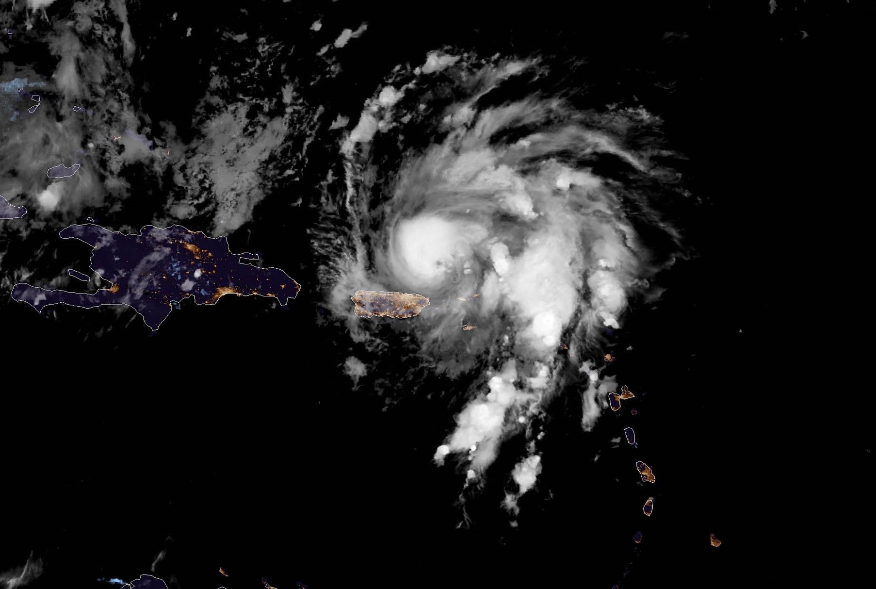
Dorian is expected to produce the following rainfall accumulations:
Northern Leeward Islands...1 to 3 inches.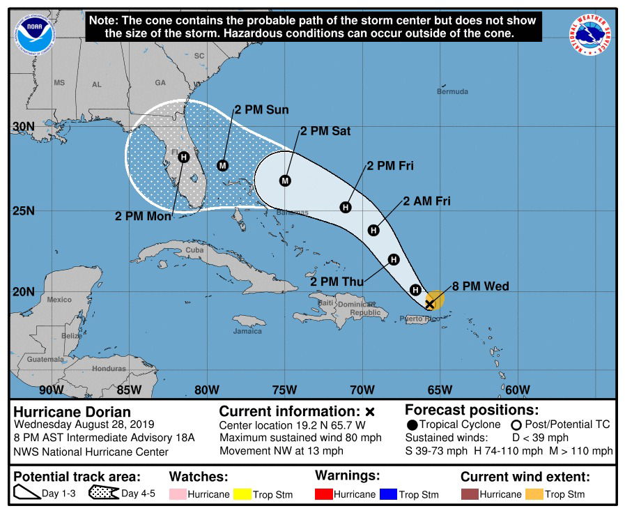 Central and northwestern Bahamas...2 to 4 inches, isolated 6 inches.Coastal sections of the Southeast U.S...4 to 8 inches, isolated 10 inches.
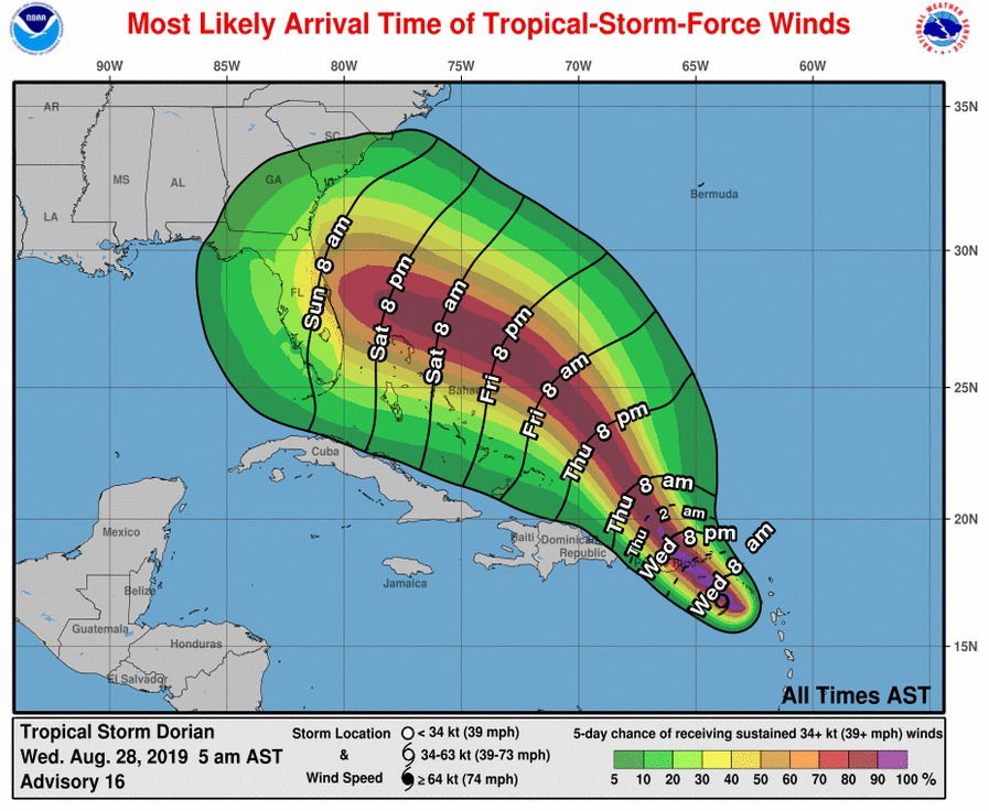 This rainfall may cause life-threatening flash floods.
The risk of dangerous storm surge and hurricane-force winds later this week and this weekend continues to increase in the central and northwestern Bahamas and along the Florida east coast, although it is too soon to determine where these hazards will occur. Residents in these areas should ensure they have their hurricane plan in place and not focus on the exact forecast track of Dorian's center.
Get the very latest information regarding Dorian at www.nhc.noaa.gov/#Dorian